Geotrail: Promoting Active Transportation Off-Road
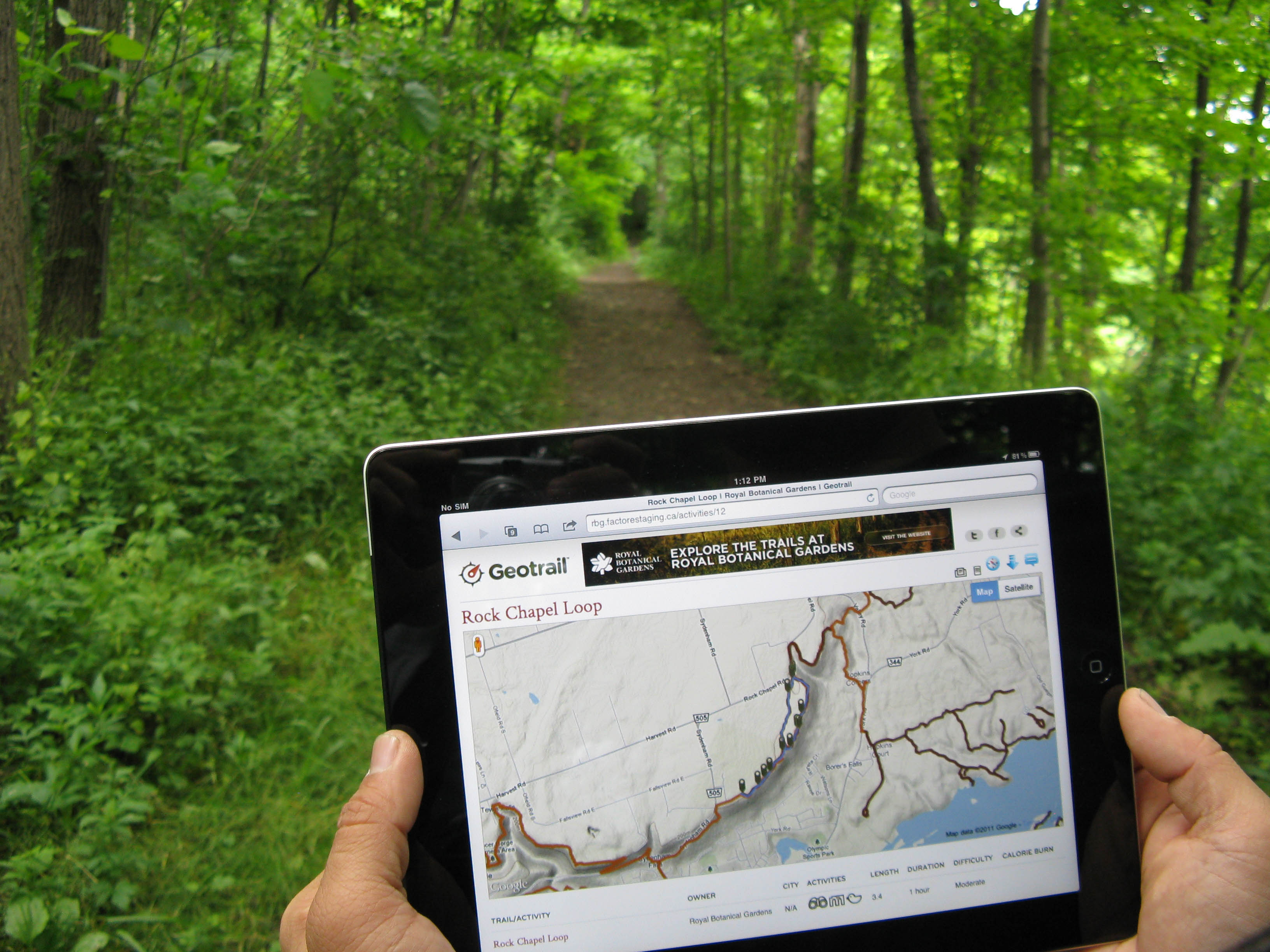
There are a whole myriad of online and mobile tools that curate experiences for people in the urban environment. Whether it’s restaurants or a walking tour, there are endless recommendations available on how to spend your time in cities. But what about the natural environment? Specifically, how can online tools help promote active transportation off-road. Geotrail is an award-winning website that promotes hiking and outdoor education by helping users discover what surrounds them. Civicplan has been a partner in helping to develop and expand this platform.
The following is adapted from an article published in Escarpment Views magazine that describes some of the hikes that can be found on Geotrail.
Steeltown’s Other Side
For a city whose image is so linked with gritty industrial landscapes, it may come as a surprise to many that Hamilton’s biggest defining feature is actually a UNESCO World Biosphere Reserve.
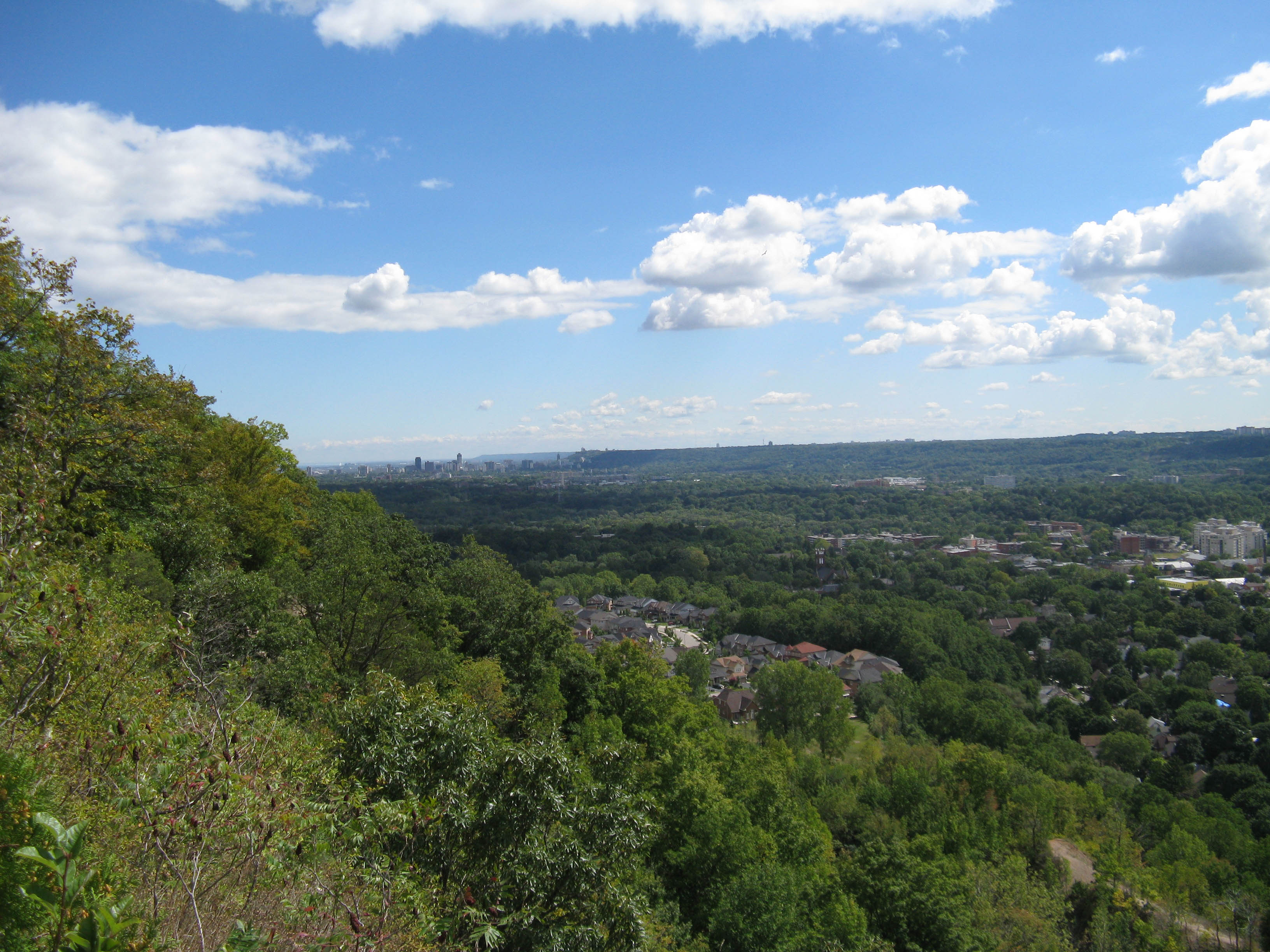 The UNESCO-designated Niagara Escarpment, or “mountain” as it’s known locally, winds its way through the city offering locals and visitors alike, amazing views of the community. It is part of daily life for thousands of Hamiltonians as the morning commute involves walking, driving, or cycling up and down the Escarpment. It also provides the basis for incredible waterfalls that are within walking distance of most Hamiltonians. A short hike from many residential neighbourhoods will take you to numerous waterfalls, some hidden and some spectacularly on display for all to see.
The Escarpment also shapes the terrain of the Royal Botanical Gardens which, in additional to the famous garden areas, has 27 km of trails that weave in and around the Escarpment’s waterfalls.
Interestingly, there is a historical link between the industrial heritage of the region and the Niagara Escarpment and the two intersect more than once in the history of Hamilton’s waterfalls. Many of the more-than 100 waterfalls in the Hamilton area are easily accessible to the public and there are a few walks in particular that make for a great day’s hike. Adventurers can grab a trail map or for the more tech savvy, check out the web-tool Geotrail.ca that shows visitors how to get outside and enjoy some of the best hikes in the area. Here are a few hikes that will take you to the best views in the region.
Webster’s Falls and Gorge Walk
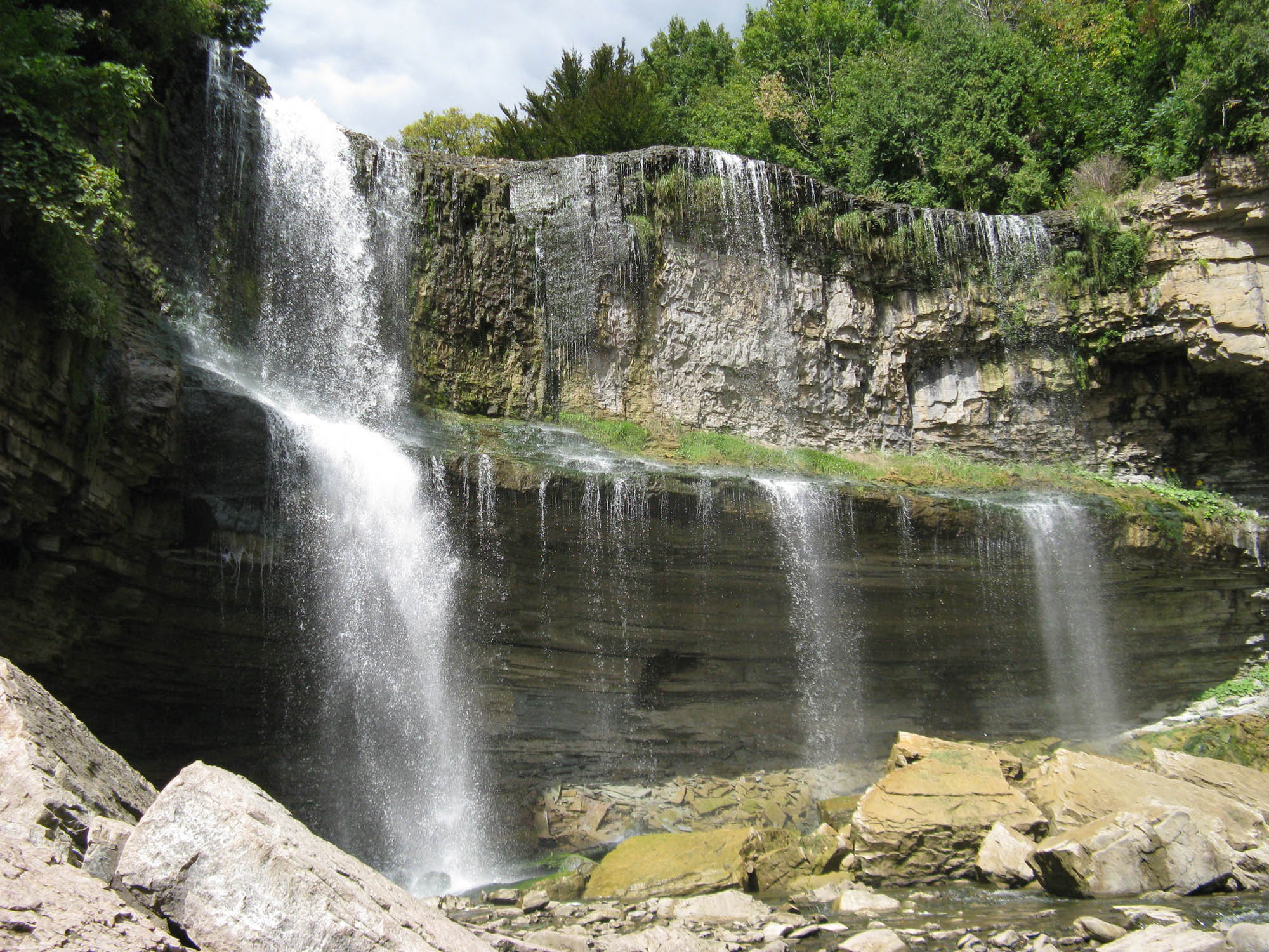 This is a popular weekend waterfall outing. On this hike you will see three amazing waterfalls and one heck of a view from the Niagara Escarpment. Starting at Cascades Park in Dundas, this hike takes you up the Escarpment passing Sydenham Falls where you will eventually come to Dundas Peak, an outcropping with a view second to none. Catch your breath, take a break and a photograph. Looking east you will see Cootes Paradise, the westernmost part of Lake Ontario and even further in the distance, the skyline of downtown Hamilton. Continuing along the trail, you will come to Tews Falls, the tallest waterfall in the Hamilton region with a drop of over 40 metres. With the spring runoff, this waterfall is in its prime, although it’s impressive year round. Moving even further west, you come to one of the most famous falls in the region, Webster’s Falls, named for the Webster family who purchased the surrounding lands in 1819. Webster’s Falls is captured on countless postcards and has been the most frequently visited waterfall in Hamilton for more than a century and has even appeared in a few Hollywood movies. In total, a round trip on this hike will take you about three hours and the walk back is considerably easier as you are mostly going downhill.
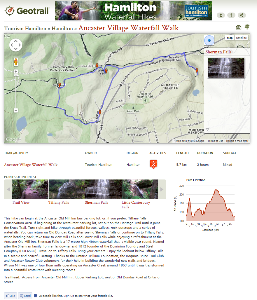
Ancaster Village Waterfall Walk
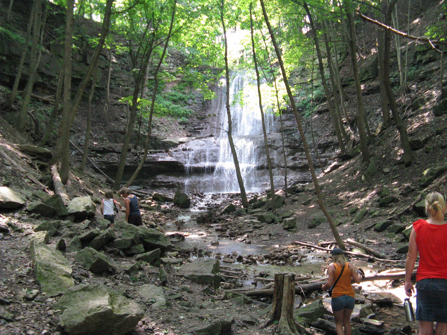 Another great adventure is on the south-facing part of the Niagara Escarpment. Starting at Tiffany Falls Conservation Area, the first stop is the immediate namesake of the area, Tiffany Falls. The trek to the falls is a winding path up a ravine, over bridges until you eventually reach the falls which presents itself like a hidden geological treasure found in an Indiana Jones movie. There is a viewing deck for the falls and if you venture there in the winter, you might catch a group of ice climbers working their way to the top. Further west, you find an equally enchanting site, Sherman Falls, named after the Sherman family, former landowner and 1912 founder of the Dominion Foundry and Steel Company (DOFASCO). Sherman Falls is a 17-metre ribbon waterfall that is visible year round. At this point you can head back, or loop around to the Ancaster Old Mill Inn and take a break to have some refreshment while enjoying the Mill Falls and Lower Mill Falls. In total, you are looking at about a two-hour outing.
 These hikes offer just a glimpse of the beauty of the Niagara Escarpment in the Hamilton region. In order to promote Steeltown’s other side, the Royal Botanical Gardens partnered with Geotrail, to bring their entire trail network to the growing online map that showcases more-than 1,000 trails. With a few clicks of a mouse you can browse through a variety of trails in the Hamilton region, and take a closer look at specific hikes with photos and additional information. Once you find a hike that interests you, you can print out a map or take the map with you on a smartphone or tablet. In Summer 2017, the RBG and Geotrail expanded their partnership and launched two new canoe routes on the Geotrail website helping users get on the water and explore Cootes Paradise. To view more hikes (and now canoe routes) in the Hamilton region, check out rbg.geotrail.ca
Remember to stay safe when visiting Hamilton waterfalls: Waterfalls are fantastic to visit, but hikers and bikers should take care around them. Always stay on signed trails and use designated areas and platforms to view waterfalls. To find more waterfall hikes, check out hamiltonwaterfalls.geotrail.ca
———————-
This article is an adapted reprint of an article first published in Escarpment Views Magazine that highlights the award-winning trail mapping platform, Geotrail.